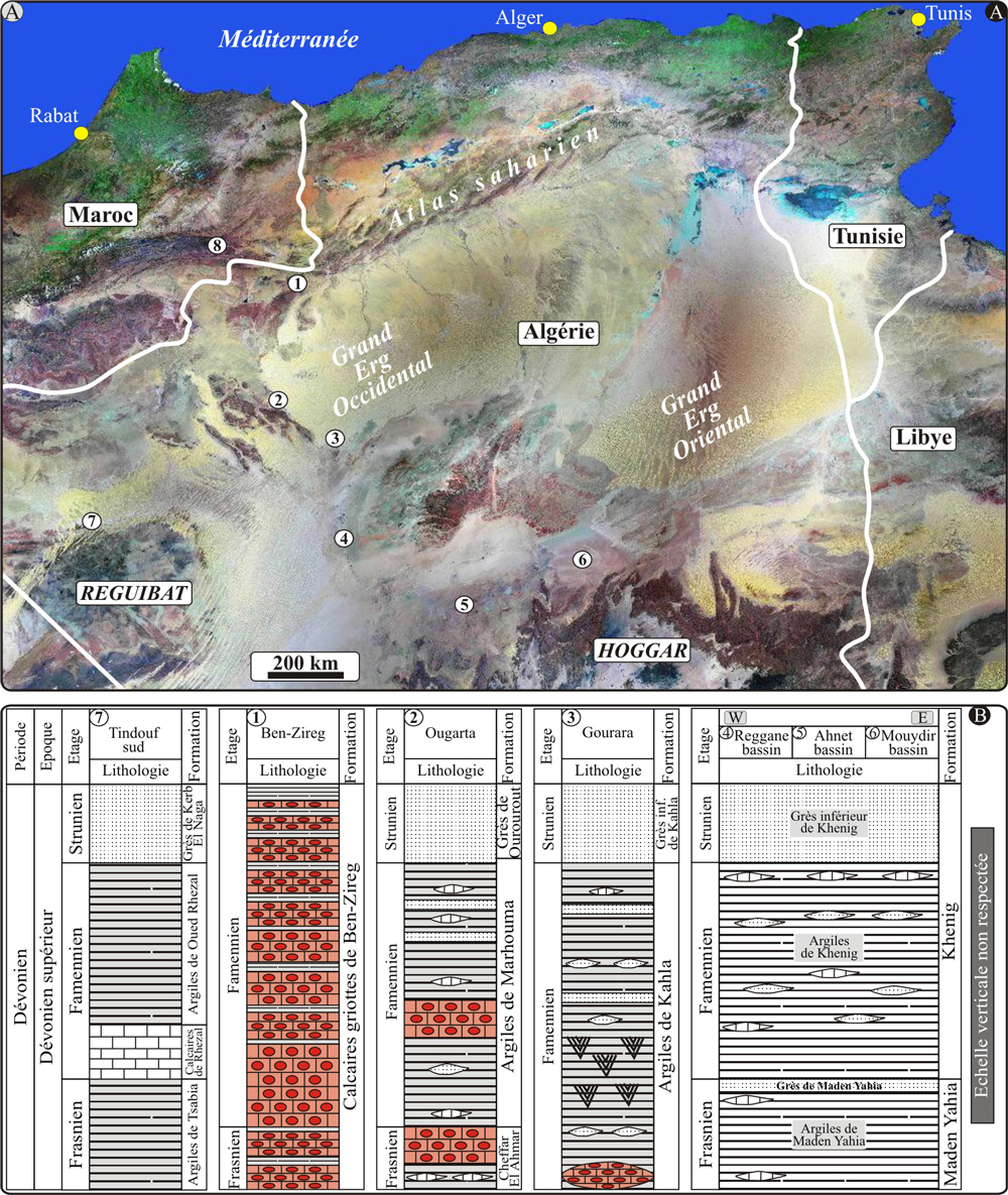
Figure 11 :
(A) Image satellitaire (Google Earth) montrant la localisation des affleurements du Dévonien supérieur dans les bassins sahariens : 1) Béchar
(Ben-Zireg), 2) Ougarta (Marhouma), 3) Gourara (Charouine), 4) Reggane, 5) Ahnet, 6)
Mouydir, 7) Tindouf (Sud), 8) Anti-Atlas ; (B) Corrélation entre formations et faciès du Dévonien supérieur dans les bassins sahariens occidentaux.
Figure 11: (A) Satellite image (Google Earth) showing the location of Upper Devonian outcrops in the Saharan basins. 1) Bechar (Ben-Zireg), 2) Ougarta (Marhouma), 3) Gourara- Charouine), 4) Reggane, 5) Ahnet, 6) Mouydir, 7) Tindouf (South), 8) Anti-Atlas; (B) Correlation between Upper Devonian formations and facies in western Saharan basins.