![]()
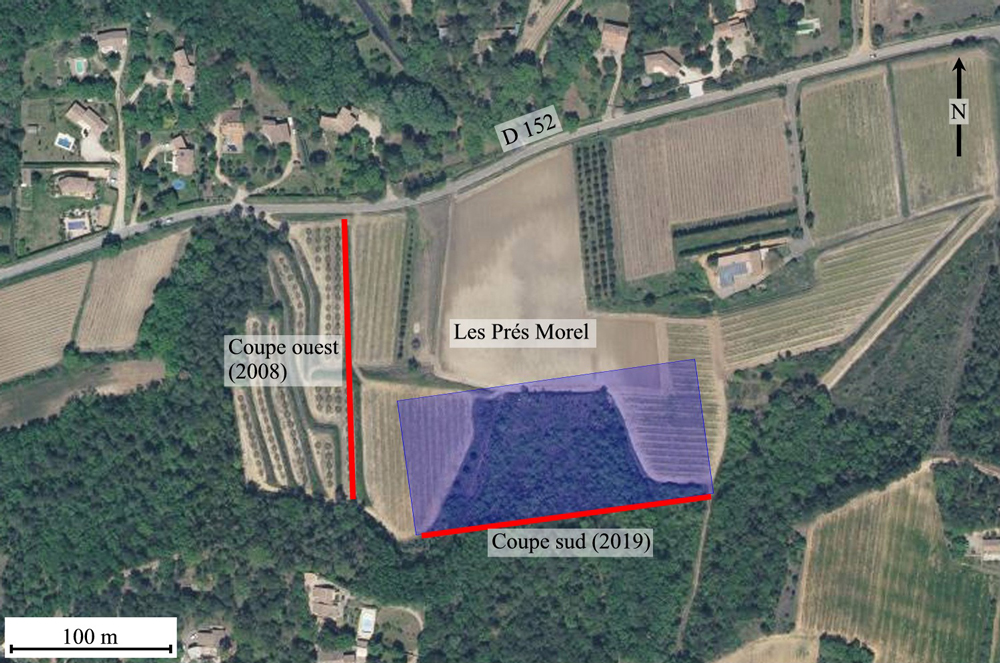
Figure 4 :
Vue aérienne de l'affleurement des Prés Morel localisé à 1 km à l'est de
Mondragon, au sud de la route départementale 152 (www.geoportail.gouv.fr). Les terrasses supportant les plantations d'oliviers visibles sur la partie gauche de la photo correspondent à la coupe
ouest, dégagée en 2008 mais levée en 2014 (trait rouge vertical). L'aire bleutée représente la partie défoncée en 2019 et le trait rouge horizontal le front de taille d'où proviennent les ammonites décrites ici (coupe
sud). Ce nouvel affleurement a été métré et décrit sur le plan de la lithologie en mai 2021.
Figure
4:
Aerial view of the Prés Morel outcrop at about 1 km east of Mondragon, south of the departmental road 152
(www.geoportail.gouv.fr). The terraces -with olive tree-grove can be seen on the left part of the photograph- correspond to the western outcrop, worked in 2008 and described in 2014 (vertical red line). The bluish surface is the cup up part in 2019 and the horizontal red line represent the trench from where were collected the ammonites described here (southern section). This new outcrop was measured and lithologically described in May 2021.