![]()
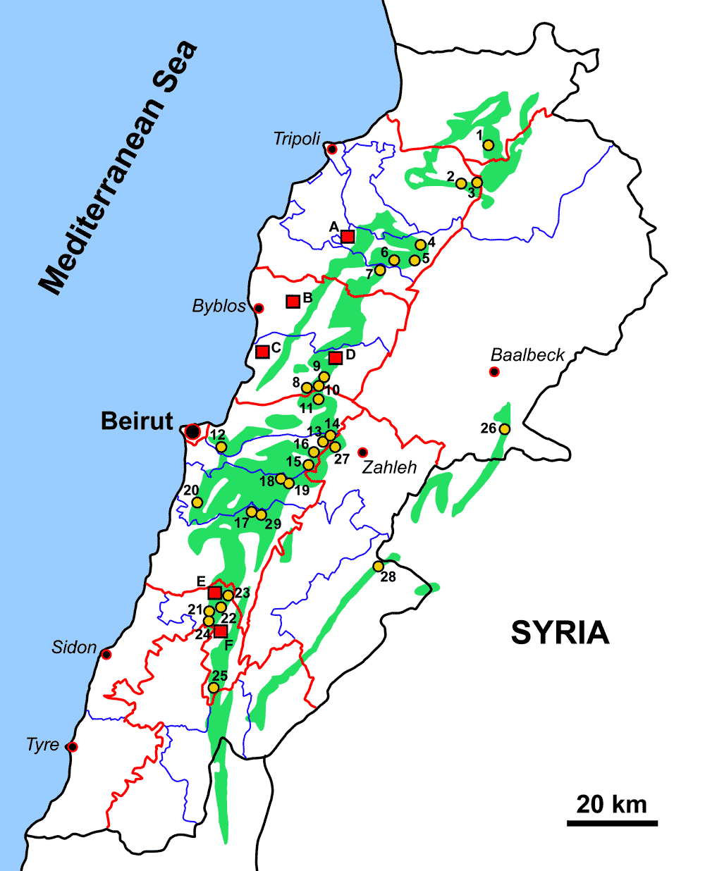
Figure 1: Location map of Lebanese outcrops with fossil insects. Green areas indicate the distribution of the amber localities. Yellow circular spots indicate the locations of Lower Cretaceous amber outcrops with insect inclusions. Red squares indicate the locations of the outcrops with fossil insects preserved as compression-impression. Amber outcrops with insects: (1) Mechmech (Ain El-Khyar); (2) Nimrin (El-Dabsheh); (3) Brissa; (4) near Bcharreh; (5) Beqaa Kafra; (6) Hadath El-Joubbeh; (7) Tannourine; (8) Mazraat Kfardibiane; (9) Ouata El-Jaouz; (10) Bqaatouta (El-Shqif); (11) Baskinta (Qanat Bakish); (12) Daychouniyyeh; (13) Kfar Selouan; (14) Kfar Selouan (Khallet Douaiq); (15) Mdeyrij-Hammana; (16) Falougha; (17) Ain Zhalta; (18-19) Ain Dara (two localities); (20) Sarhmoul; (21) Roum - Aazour - Homsiyeh; (22) Bkassine (Jouar Es-Souss); (23) Wadi Jezzine; (24) Maknouniyeh; (25) Rihane; (26) Esh-Sheaybeh; (27) Bouarij; (28) Aita El-Foukhar; (29) Ain Zhalta (Ain Azimeh). Outcrops with fossil insects preserved as compression-impression: (A) Qnat; (B) Hjoula; (C) Nammoura; (D) Qahmez; (E) Jdeidet Bkassine; (F) Sniyya. Red curves: boundaries of Governorates; blue curves: boundaries of districts.