![]()
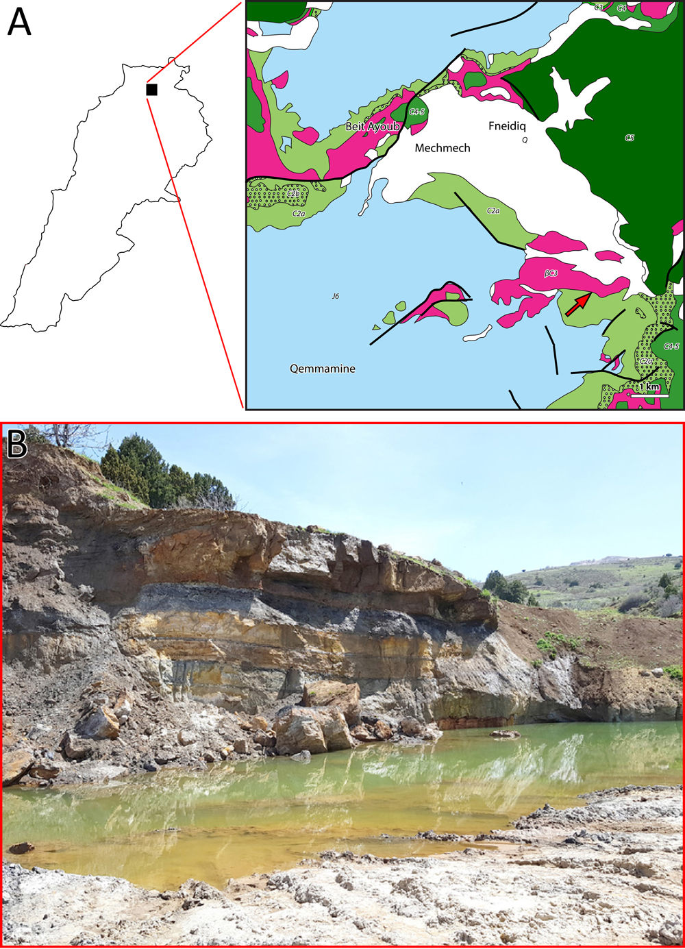
Figure 3: A-
Geological map: fossiliferous outcrop of Mechmech (Ain El-Khyar) (red arrow)
outcrop (modified after Dubertret, 1951c;
Guerre, 1975). J6 = uppermost Jurassic; C2a = lower Barremian "Grès
du Liban" sandstone; C2b = Barremian clay and oolitic deposition of the upper
part of the "Grès du Liban" and oolitic deposition of the lower part of the
Jezzinian; C3
= micritic part of the Jezzinian (uppermost Barremianlowermost Aptian); C4 =
Albian; C4-5 = AlbianCenomanian; C5 = Cenomanian; Q = Quaternary scree; βC3 = Jezzinian
volcanic deposition. Thick lines represent faults. Scale bar = 1 km. B-
General view of the outcrop of Mechmech (Ain El-Khyar).