![]()
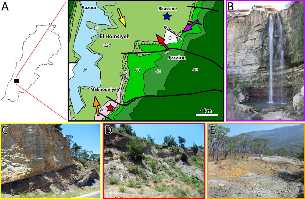
Figure 11: A- Geological map: Jdeidet Bkassine (blue star) and Sniyya (red star) dysodile outcrops and of the Roum - Aazour - Homsiyeh (yellow arrow), Bkassine (Jouar Es-Souss) (red arrow), Wadi Jezzine (purple arrow), Maknouniyeh (orange arrow) amber outcrops (modified from Dubertret, 1950). J6 = uppermost Jurassic; C1 = Salima Formation (lower Valanginian); C2a = lower Barremian "Grès du Liban" sandstone; C2b = Barremian clay and oolitic deposition of the upper part of the "Grès du Liban" and oolitic deposition of the lower part of the Jezzinian; C3 = micritic part of the Jezzinian (uppermost Barremianlowermost Aptian); C4 = Albian; C5 = Cenomanian; Q = Quaternary scree; βC2 = Barremian volcanic deposition. Thick lines represent faults. Scale bar = 1 km. B- General view of Wadi Jezzine outcrop. C- General view of Roum - Aazour - Homsiyeh outcrop. D- General view of Bkassine (Jouar Es-Souss) outcrop. E- General view of Maknouniyeh outcrop.