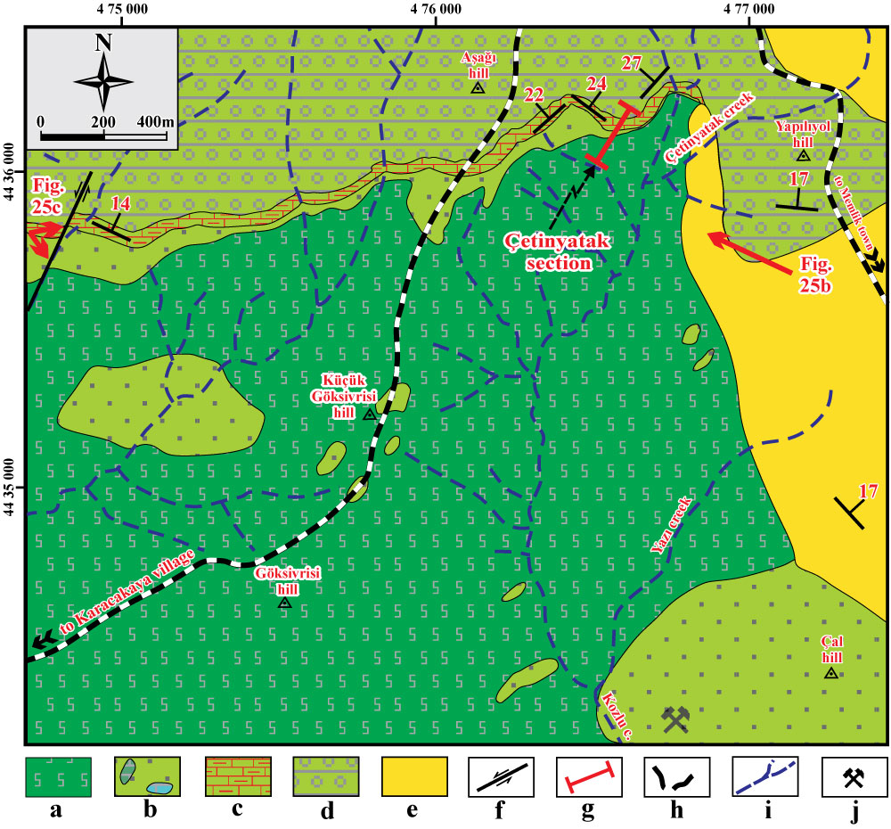

Figure 13: Geological map
of the west of Memlik region, showing the stratigraphical/structural units and
location of the Çetinyatak section. Key:
a. Ophiolitic mélange with dismembered oceanic suite belonging to the
Neotethys Izmir-Ankara-Erzincan Ocean, b.
The Coniacian Elmadağ Olistostrome with mainly pelagic carbonate blocks, c.
The Santonian Unaz Formation with basal clastics, d. The Campanian-Maastrichtian Haymana Formation, e.
Neogene deposits, f. Strike-slip
fault, g. Location of the Çetinyatak
section, h. Main roads, i. Drainage system, j.
Limestone quarry (redrawn and mainly revised after Kazancı & Gökten,
1986; Gökten et al., 1988; Koçyiğit
et al., 1988; Koçyiğit, 1991). Red arrows indicate the
directions of the photographs in Fig. 25.b-c.
