|
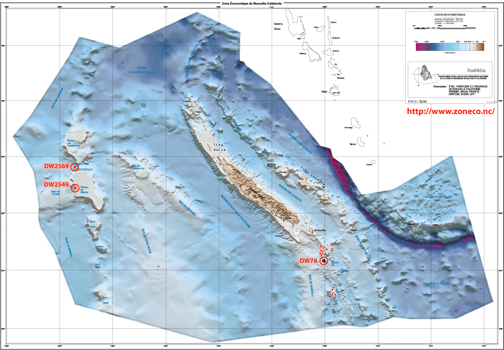
Chart of the
French Exclusive Economic Zone
(New Caledonia)
- click on to enlarge -

1. Laurin (1992) ; 2. Bitner (2009); 3. Robinson (2014);
4. Cohen et al. (2014).
|
Norkfolk ridge
CHALCAL II Cruise, st. DW78 : 23°41'3S, 167°59'6E ; 233 m - type locality (1)
BIOCAL Cruise, st. DW64 : 24°47'9S, 168°09'1E ; 250 m - paratypes (1)
CP1690 : 24°54'S, 168°22'E ; 514-515 m
CP2119 : 23°22.75'S, 168°01.64'E ; 300 m (2)
DW1651 : 23°27.35'S, 167°50.4'E ; 276-350 m, 2001 (2, 3)
DW1653 : 23°28'S, 167°51'E ; 328-340 m (2)
DW1654 : 23°28'S, 167°52'E ; 366-560 m (2)
DW1657 : 23°28'S, 167°52'E ; 305-332 m (2)
DW1658 : 23°26'S, 167°50'E ; 320-336 m (2)
DW1675 : 24°45'S, 168°09'E ; 231-233 m (2)
DW1679 : 24°43'S, 168°10'E ; 298-324 m (2)
DW1722 : 23°18'S, 168°01'E ; 540 m (2)
DW1729 : 23°20'S, 168°16'E ; 340-619 m (2)
DW2023 : 23°24.04’S 167°50.72’E ;282-297 m, 2003 (2)
Chesterfield Islands:
EBISCO Cruise, st. DW2549, 21°07'00S, 158° 38'00E; 330-331 m, on the barrier reef slope of the Bellona atoll (West coast), on old limestone substrat (Bertrand Richier de Forges, in charge of the expedition) (4)
EBISCO Cruise, st. DW2569, 20°23'59S, 158°40'00E; 100 m (NW Bellona)(Bertrand Richier de Forges, in charge of the expedition) (4)
|