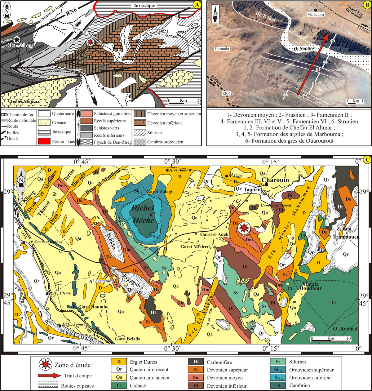
Figure 2
: Cadre géologique des trois régions étudiées : (A) bassin de Béchar (Ben
Zireg) (d'après
Pareyn, 1961, modifié) ; (B) bassin de l'Ougarta (Marhouma) (image d'arrière-plan d'après Google
Earth) ; (C) bassin du Gourara (Charouine) (Carte de Kerzaz, modifiée).
Figure 2: Geological setting of the three studied areas: (A) the Bechar Basin (Ben Zireg) (after
Pareyn, 1961, modified); (B) the Ougarta Basin (Marhouma) (background image from Google Earth); (C) the Gourara basin (Charouine) (Map of Kerzaz, modified).