![]()
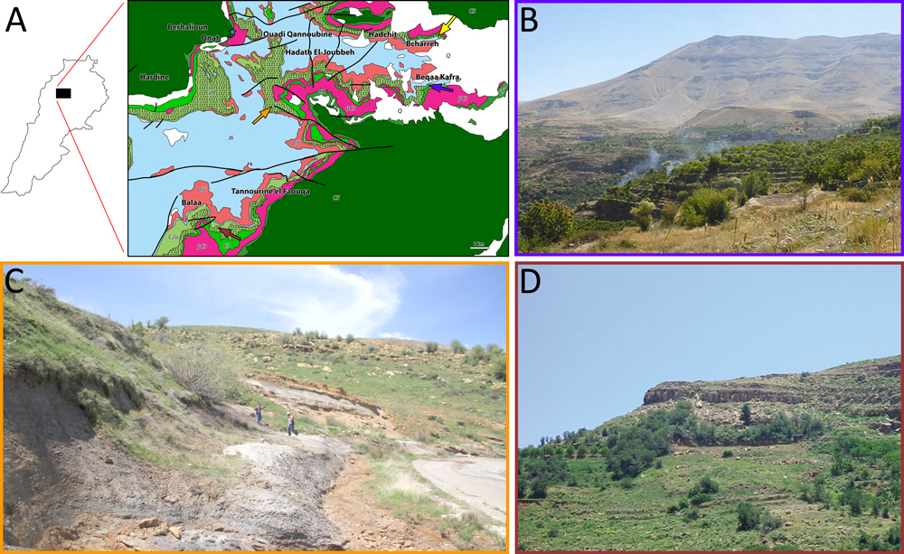
Figure 5: A- Geological map: fossiliferous outcrops of Bcharreh (yellow arrow), Beqaa Kafra (blue arrow), Hadath El-Joubbeh (orange arrow), Tannourine (brown arrow) and Qnat (clear blue star) outcrops (modified after Dubertret & Wetzel, 1945, 1951; Dubertret, 1949b, 1951c). J6 = uppermost Jurassic; C2a = lower Barremian "Grès du Liban" sandstone; C2b = Barremian clay and oolitic deposition of the upper part of the "Grès du Liban" and oolitic deposition of the lower part of the Jezzinian; C3 = micritic part of the Jezzinian (uppermost Barremianlowermost Aptian); C4 = Albian; C5 = Cenomanian; Q = Quaternary scree; βJ6 = Kimmeridgian volcanic deposition; βC3 = Jezzinian volcanic deposition. Thick lines represent faults. Scale bar = 1 km. B- General view of Beqaa Kafra outcrop. C- General view of Hadath El-Joubbeh outcrop. D- General view of Tannourine outcrop.