![]()
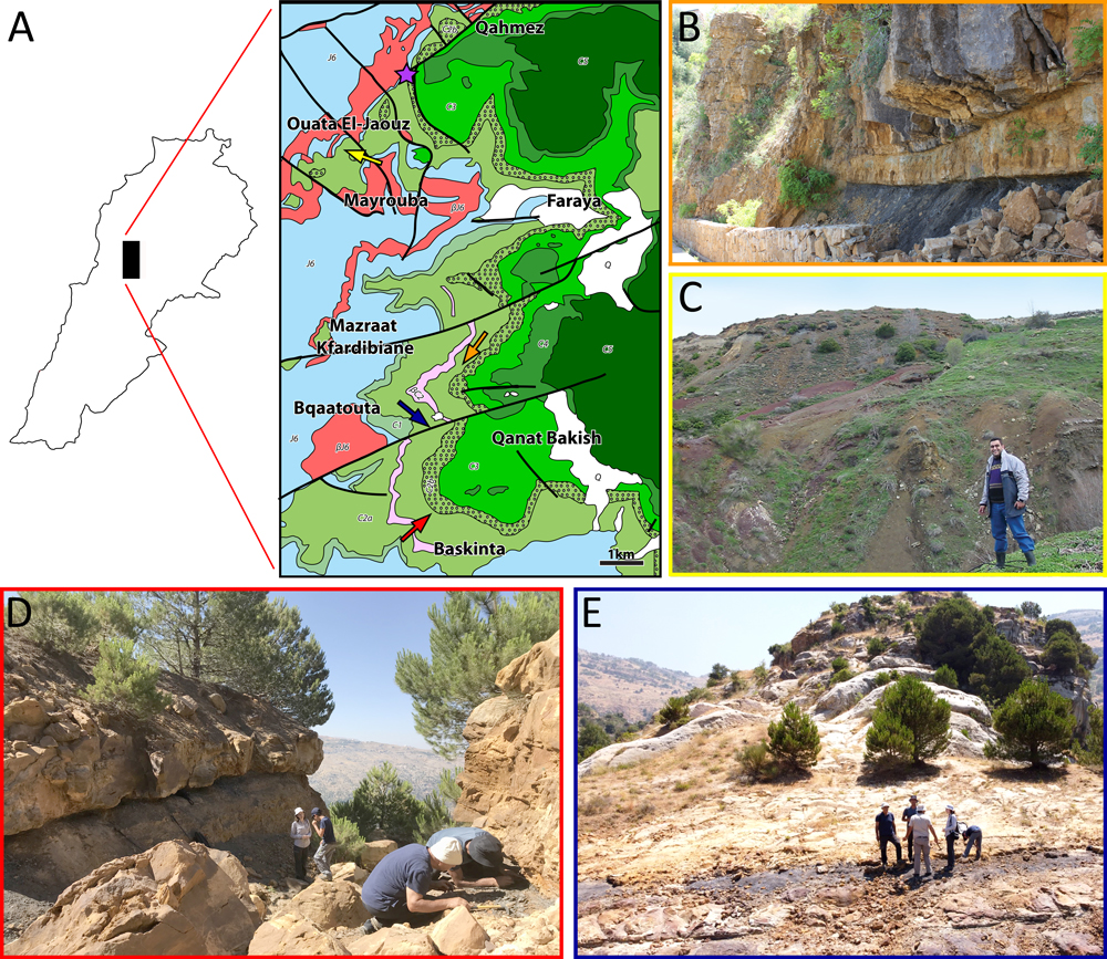
Figure 6: A- Geological map: Ouata El-Jaouz (yellow arrow), Mazraat Kfardibiane (Red Rock) (orange arrow), Baskinta (Qanat Bakish) (red arrow), Bqaatouta (blue arrow) and Qahmez (purple star) outcrops (modified from Dubertret, 1945, and Dubertret & Wetzel, 1945). J6 = uppermost Jurassic; C1 = Salima Formation (lower Valanginian); C2a = lower Barremian "Grès du Liban" sandstone; C2b = Barremian clay and oolitic deposition of the upper part of the "Grès du Liban" and oolitic deposition of the lower part of the Jezzinian; C3 = micritic part of the Jezzinian (uppermost Barremianlowermost Aptian); C4 = Albian; C5 = Cenomanian; Q = Quaternary scree; βJ6 = Kimmeridgian volcanic deposition; βC2 = lower Barremian volcanic deposition. Thick lines represent faults. Scale bar = 1 km. B- General view of Mazraat Kfardibiane outcrop. C- General view of Ouata El-Jaouz outcrop. D- General view of Baskinta (Qanat Bakich) outcrop. E- General view of Bqaatouta outcrop.