![]()
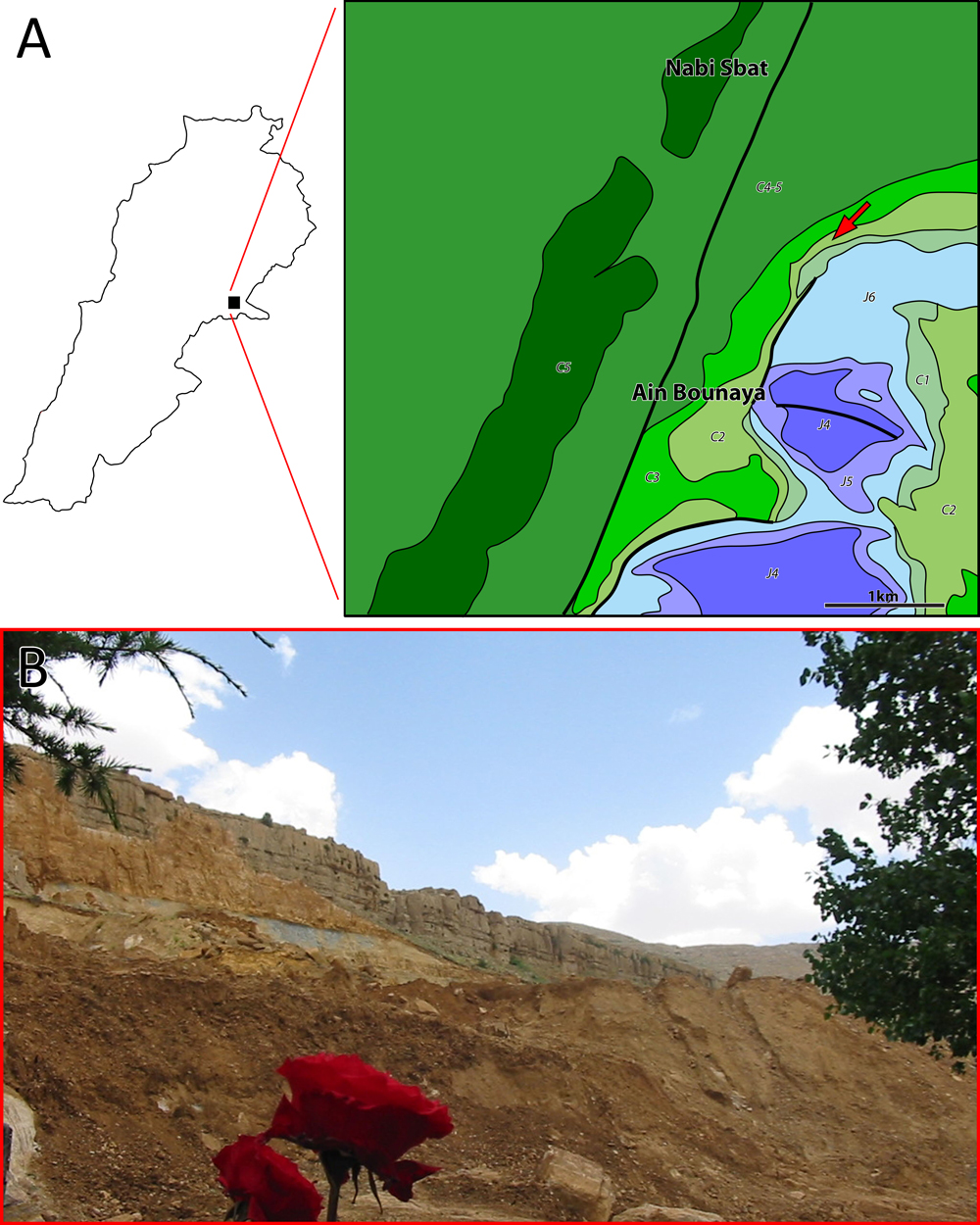
Figure 13: A- Geological map: Esh-Sheaybeh (red arrow) amber outcrop (modified from Dubertret, 1949b). J4 = Middle Jurassic; J5 = Oxfordian; J6 = uppermost Jurassic, Kimmeridgian; C1 = Salima Formation (lower Valanginian); C2 = lower Barremian "Grès du Liban" sandstone; C3 = micritic part of the Jezzinian (uppermost Barremianlowermost Aptian); C4 = Albian; C5 = Cenomanian; C4-5 = Albian - Cenomanian. Thick lines represent faults. Scale bar = 1 km. B- General view of Esh-Sheaybeh outcrop.