![]()
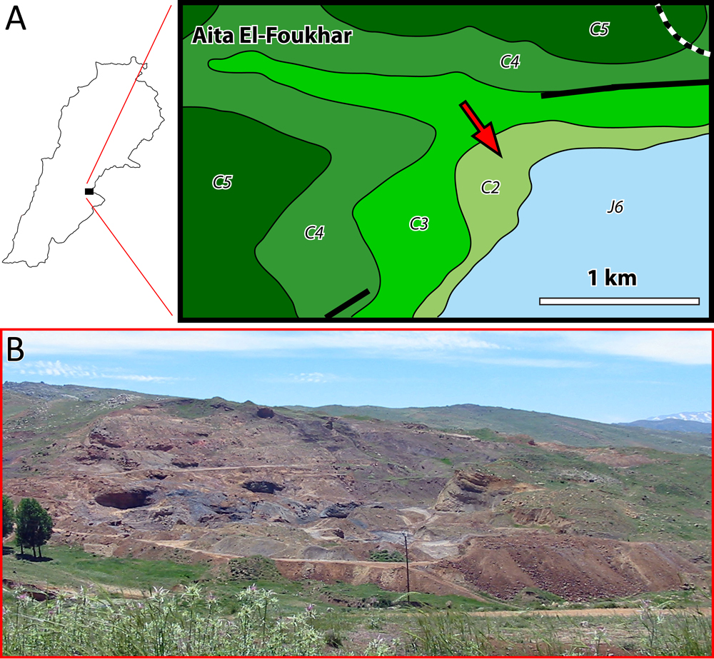
Figure 14: A- Geological map: Aita El-Foukhar (red arrow) amber outcrop (modified from Dubertret, 1960). J6 = uppermost Jurassic; C2 = lower Barremian "Grès du Liban" sandstone; C3 = micritic part of the Jezzinian (uppermost Barremianlowermost Aptian); C4 = Albian; C5 = Cenomanian. Thick lines represent faults. Scale bar = 1 km. Thick lines represent faults. Dotted line represents the boundary between Lebanon and Syria. Scale bar = 1 km. B- General view of Aita El-Foukhar outcrop.